Google/Waze Integration – Highways
When animals are detected near roads, the system sends alerts directly to Google Maps and Waze, marking the animal's location for nearby drivers to slow down proactively.
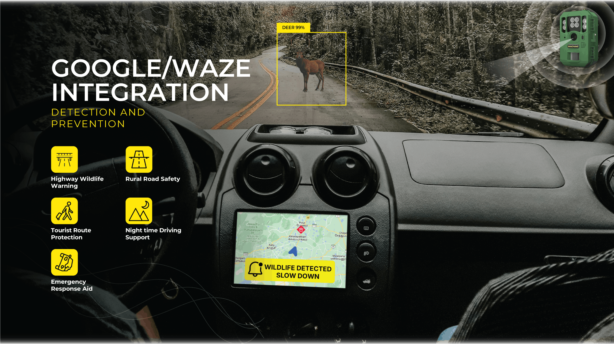
When animals are detected near roads, the system sends alerts directly to Google Maps and Waze, marking the animal's location for nearby drivers to slow down proactively.
Many drivers remain unaware of wildlife activity on roads, particularly in areas with frequent animal movement, leading to a heightened risk of collisions. Without timely alerts, the chances of roadkill and vehicle damage increase significantly. Traditional roadside warning systems often fail to deliver real-time updates to all drivers, reducing their effectiveness.

This system detects animals near roads and sends real-time alerts directly to popular navigation apps like Google Maps and Waze. Drivers receive notifications showing the exact location of the animal, allowing them to slow down and avoid potential accidents. By leveraging widely used apps, the system ensures broad and timely awareness, improving safety in known wildlife crossing zones.

Discover the power of our sound and vision algorithms through real-world applications. Watch the video to learn how Innovation Factory is shaping the future of safety, security, and more.
See DeterCam in action as it spots wildlife in natural settings. These clips show how AI-powered detection helps protect property, reduce risks, and support safe coexistence with animals.


Join the Innovation Factory